|
This site is a personal web
site run by John Saville and is not endorsed by Enesco or the Lilliput
Lane Collectors Club. All information is provided on a "best efforts"
basis and no responsibility can be taken for lost time or finance if
relied on.
Webmaster: john-saville@ntlworld.com |
|
Return to LL Norfolk |
Name |
Original |
Town |
Visit |
LL Ref. |
Dates |
Actual Location |
Grid Ref. |
IoE |
 |
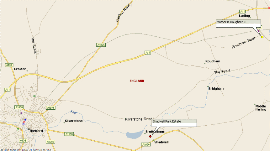
Mother & Daughter |
 |
Roudham |
Private dwelling |
L2636 |
|
"The Lodge", West Lodge to Roudham Hall |
N52.4474
E0.8782 |
219873
BLB |
|
We think Lilliput
Lane's "Mother & Daughter" is based on
a cottage in Roudham. |
|
There are a number of similar buildings
in the area, and differences between the model and deed photo, which
causes confusion.
The confusion is that the deed card states both
Roudham and ..."built to enhance the Shadwell Estate".
From Roudham to the
main part of the current Shadwell Estate is 4.4 miles direct. There are
also buildings similar to this one on the current estate. |
|
Debbie Gill writes the following which
clarifies things:
"Mother & Daughter was a different
pair of cottages than the ones you have photographed. We too found
those first. Further along Roudham Road we turned right down a
track. This led to the Mother & daughter (IOE
219873). The gate had The Lodge written on it. It was next to a
ruin and opposite the entrance to a farm. Unfortunately I can't
remember the farm's name. The ruin with the cottage side caught in
the photo can be found at
http://www.norfolkchurches.co.uk/roudham/roudham.htm ."
|
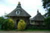
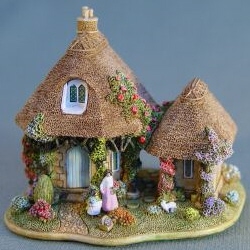 |

Photo: Debbie Gill |
 |
|
| Photo from deed reproduced without
permission |
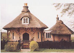
Photo: Debbie Gill |
| The building depicted on the deed card
is "The Lodge", West Lodge to Roudham Hall (IOE
219873) |
 |
|
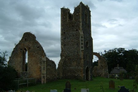
|
It is near this ruin of
St Andrew, Roudham |
|
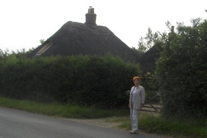 |
The one we originally identified is
South on corner of B1111 and
Roudham Road in Larling
Obviously the owners want their
privacy and have grown tall hedges.
We
wanted to respect that and did not venture photos within the boundary.
IoE
219869 &
219870
|
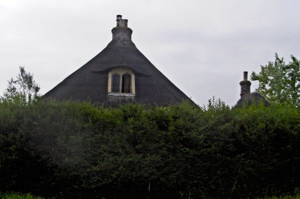 |
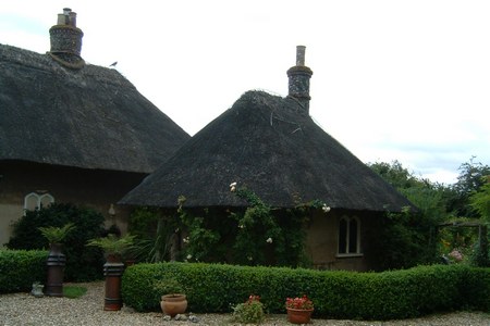
Photo: Debbie Gill |
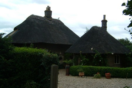
Photo: Debbie Gill |
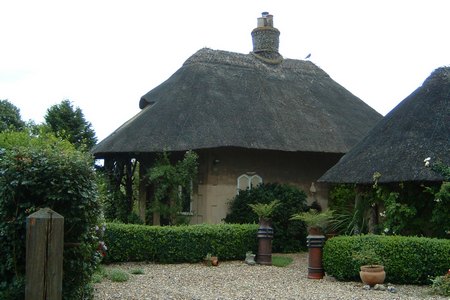
Photo: Debbie Gill |
| The map below shows the position of this
one. |